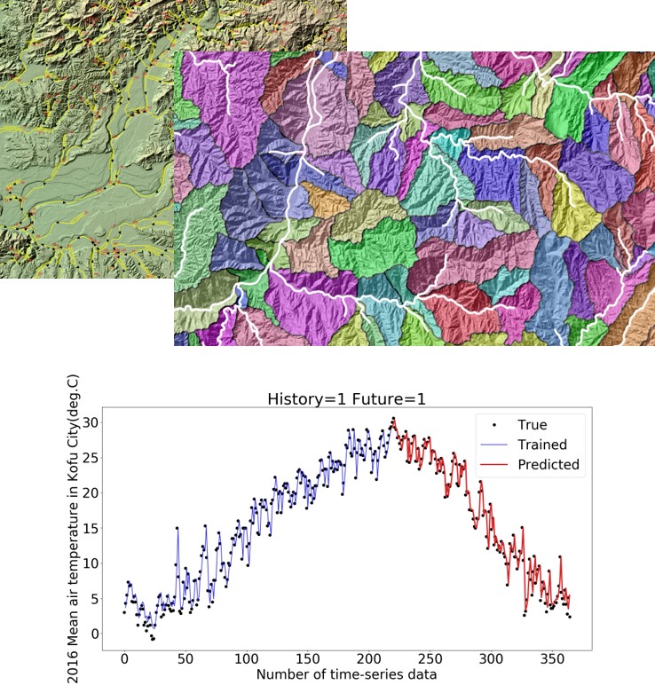
Data placed on a map can be analysed in detail, using each location (latitude and longitude) as an identifier describing the relationship between them. This is widely known as a geographic information system or GIS. In recent years, GIS has been integrated into various programming languages, statistics, web, artificial intelligence, IoT technologies, and many of which rely on open-source software.
BES provides GIS-based spatial analysis services such as geographic features, network structure of water supply, sewage, rivers, and other life infrastructure networks, reanalysis of large amounts of accumulated observational data, and modelling services using deep learning (e.g. in the field of natural renewable energy and ecosystems).