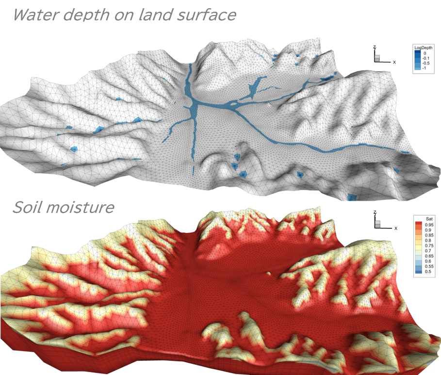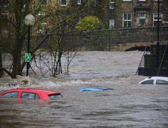
Given typhoons, storms, and other weather events seem to be becoming more extreme, we need a good understanding of the characteristics of the area in which we live, such as its topography, lowlands, and water bodies, in order to take suitable life-saving actions in the event of an evacuation.
The various hazard maps published by national and local governments are a type of information that summarises the characteristics of each area.
BES will contribute to evolve these hazard maps and guide life-saving actions by combining analysis of past flood and landslide disaster data with the most advanced computer simulation technology.